
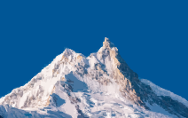
Mount Manaslu rises to 8,163 meters, making it the world’s eighth-highest mountain. The trek around it is less about reaching a single famous base camp and more about watching the landscape change day after day.
The route starts in the lower Budhi Gandaki Valley, where the air is warm and the hills are covered with farmland and forest. As you move north, the gorge tightens, suspension bridges span the river, and villages gradually take on a stronger Tibetan Buddhist character. By Lho and Samagaon, prayer flags, mani walls, chortens, and monasteries are part of the everyday scenery.
Then the trees disappear.
The upper valley around Samdo and Dharamshala is dry, rocky, and much colder. The biggest test comes with the crossing of Larkya La, officially listed by Nepal Tourism Board at approximately 5,160 meters. From there, the route drops sharply toward Bhimthang and eventually joins the Annapurna Circuit near Dharapani.
This 19-day itinerary is designed around the longer Soti Khola approach rather than the shorter itineraries that now drive farther up the Budhi Gandaki Valley. That distinction matters: road construction has changed where many operators begin the walking section, so the total distance and driving times can vary considerably between itineraries. Manaslu is still a restricted trekking area. You need the appropriate permit and must arrange the restricted-area trek through a registered trekking agency with a licensed guide. The March 2026 rule change removed the previous minimum of two foreign trekkers, meaning a traveler can now obtain a restricted-area permit individually — but solo does not mean guideless.
Info
-
Teahouses/Lodge
-
5,160 m
-
BLD
-
Moderate to Hard
-
Spring and Autumn
-
Guided
-
Kathmandu
-
English
Trek Overview
From Soti Khola, the route follows the Budhi Gandaki through warm lower valleys before climbing gradually toward Machha Khola and Jagat. The river is almost always somewhere nearby. Sometimes you are walking beside it; elsewhere you are high above it, listening to the water far below.
The character of the villages changes as the elevation increases. Around Jagat and Philim, terraced fields and traditional hill settlements dominate. Farther north, the architecture becomes more Tibetan-influenced, with stone houses, prayer flags, mani walls, and Buddhist monasteries appearing more frequently.
Namrung and Lho mark another noticeable shift. The forest begins to thin, the mountains feel much closer, and Manaslu starts appearing between the ridges.
Samagaon is the main acclimatization point in the upper valley. From here, the route continues toward Samdo and then Dharamshala before the long climb to Larkya La. After the pass, the experience changes quickly. Bhimthang is surrounded by forest and alpine pasture, and the descent eventually brings you into the Marsyangdi Valley. By Dharapani, you are back on the Annapurna Circuit and the trail feels busier and more developed.
Highlights
- • The Larkya La Pass crossing at approximately 5,160 meters
- • Tibetan-influenced villages including Lho, Samagaon, and Samdo
- • Suspension bridges and narrow trails along the Budhi Gandaki Gorge
- • Traditional monasteries, chortens, prayer flags, and mani walls
- • A gradual transition from subtropical forest to high alpine terrain
- • The dramatic descent from Larkya La toward Bhimthang
- •The point where the Manaslu Circuit joins the Annapurna Circuit
- • Close views of Manaslu, Himalchuli, Ngadi Chuli, and other Himalayan peaks